September 2025 Drought and Streamflow Update
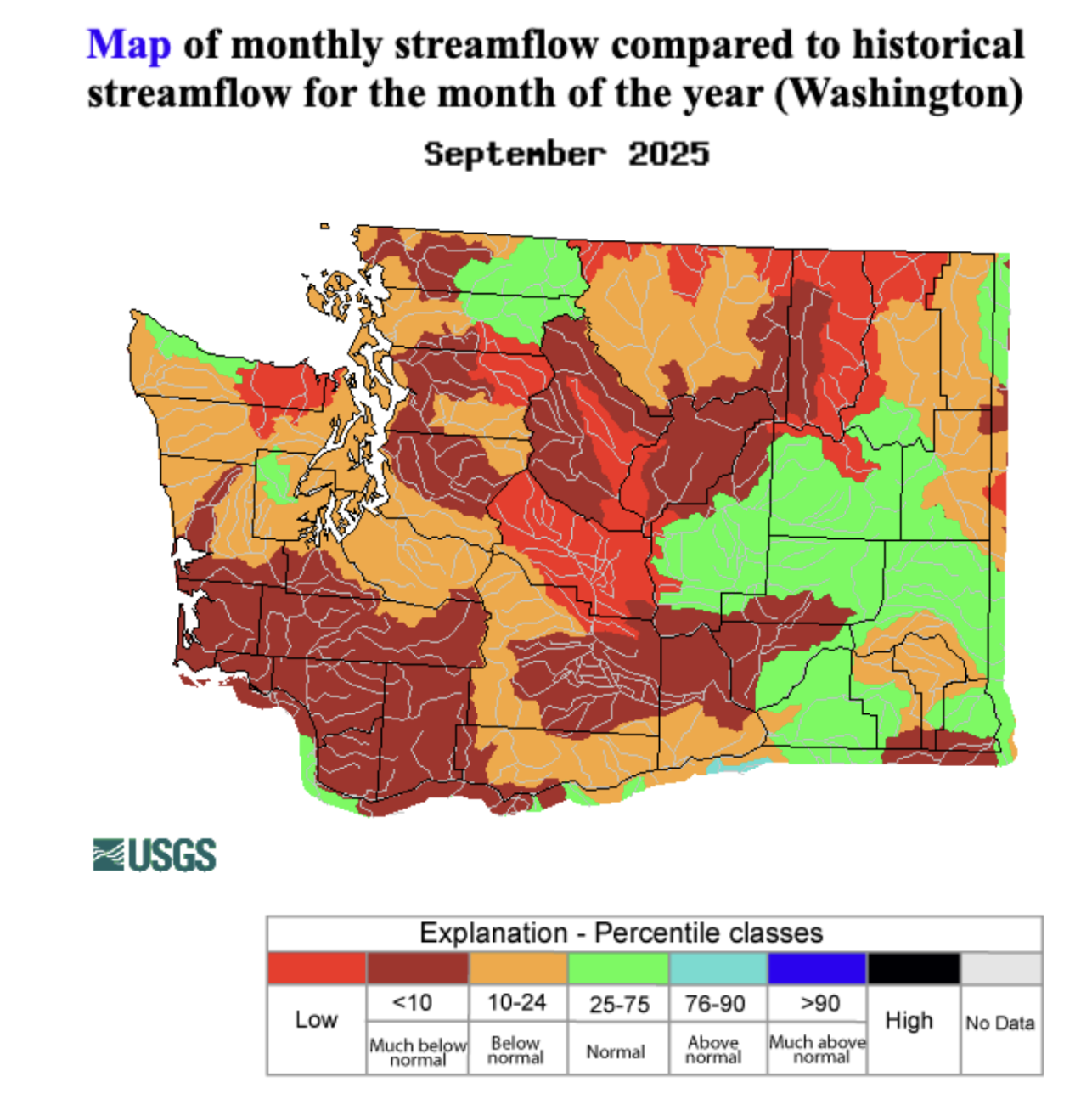
Streamflow deteriorated during September as a result of warmer than normal temperatures and a relatively slow start to the rainy season. A map of September streamflow percentiles by watershed reveals that the vast majority of watersheds are below normal or much below normal, seen in orange and brick red shading. Notably, multiple watersheds in the Cascades including the Upper Yakima watershed are near record low streamflow levels (bright red shading).
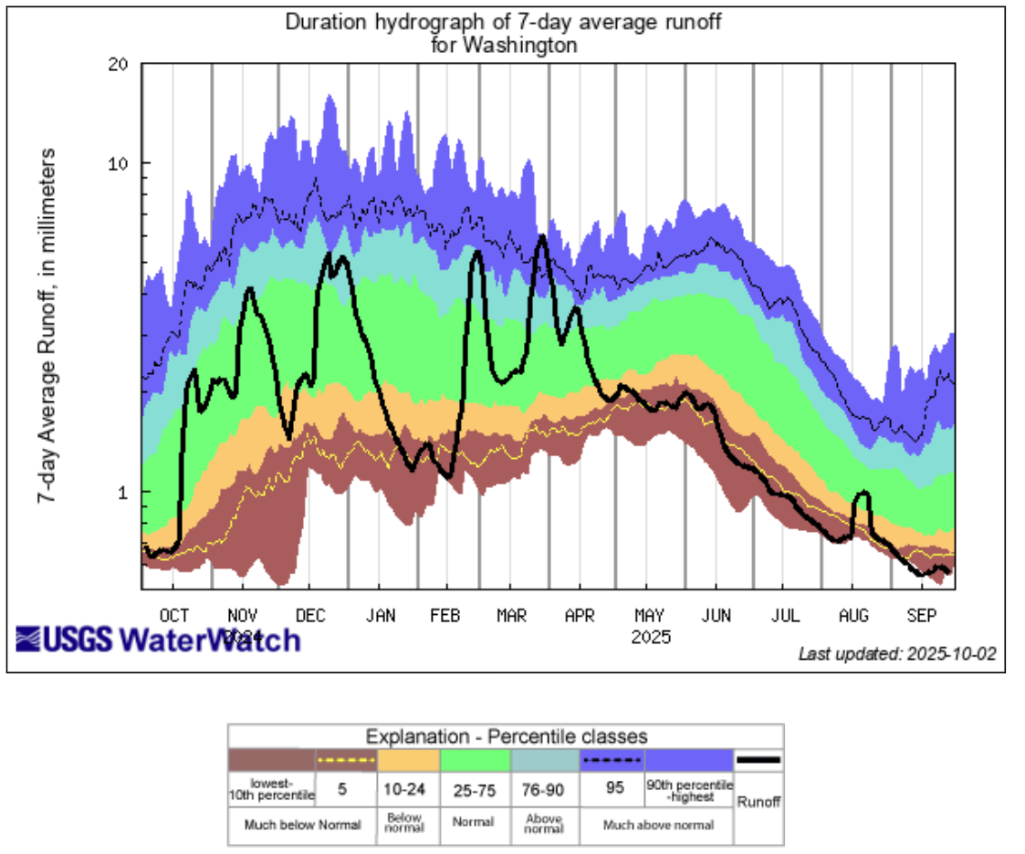
The large spatial extent of this low streamflow is shown on the graph below which represents average runoff statewide for the 2025 water year. After running consistently near record low levels since late spring, stream flow remains near record low levels and has even dropped below record lows at times in September.
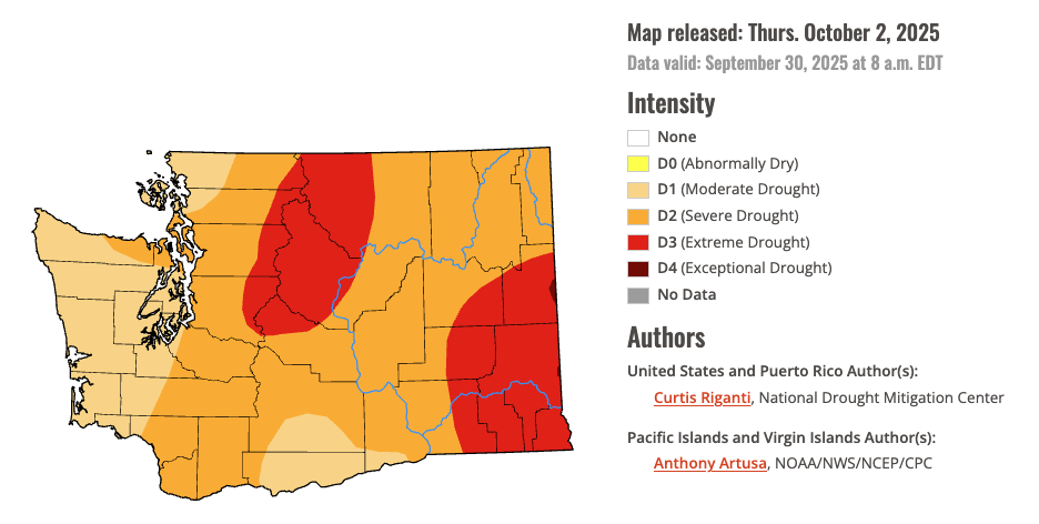
There has been little change in drought conditions over the past month, and the entire state remains in at least Moderate Drought, according to the U.S. Drought Monitor. Drought worsened in portions of southeastern Washington as D3, Extreme Drought, expanded into Adams, Franklin, and Walla Walla counties due to well above normal temperatures, much below normal rainfall over the last 4-6 months, and low soil moisture. Extreme Drought conditions remain across the northern and central Cascades as well. A very small portion of far eastern Spokane County deteriorated into D4, Exceptional Drought, the most intense drought category. D2, Severe Drought, remains across almost all of eastern Washington and the rest of the Cascades. D1, Moderate Drought, remains on the Olympic Peninsula, northern Puget Sound, and south central Washington.
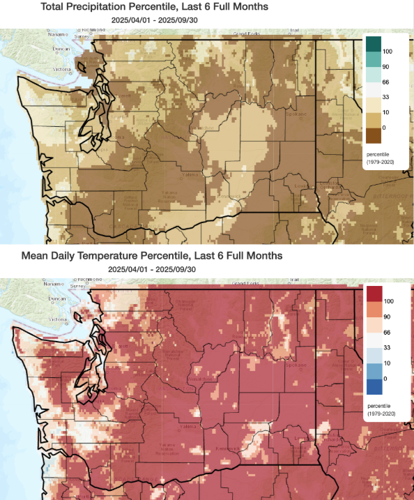
Large swaths of record dry conditions coupled with record warm conditions nearly statewide is a recipe for intensifying drought. The darkest shading on the maps of precipitation and temperature percentiles below show these record conditions from April 1st through September 30th across the state. These persistent conditions were further exacerbated by below normal snowpack at the beginning of the growing season as well as a quicker than normal melt out.