By Jacob Genuise
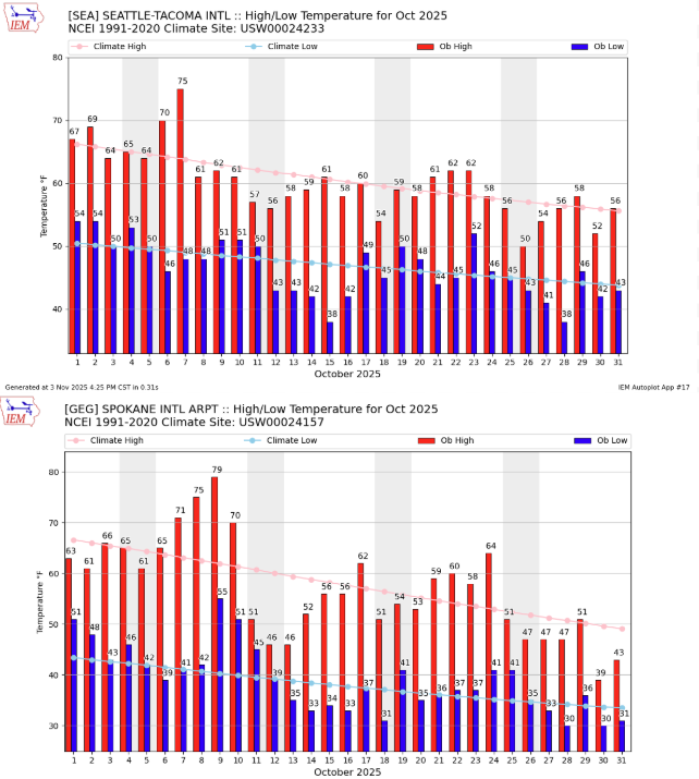 October 2025 daily high (red bars) and low (blue bars) temperatures as well as normal high and low (pink and light blue lines, respectively) for SeaTac Airport (top) and Spokane (bottom). Gray shading denotes weekends. Normals are based on the period 1991-2020.
The month kicked off with a decent rain event across western Washington followed quickly by a late-season warm spell from October 6-10. This warm spell brought what were very likely the last 70°F days of the year for most, if not all, locations across the state. On October 7, SeaTac airport rose to 75°F (SeaTac daily record: 79°F, 2023. Daily normal high temperature: 63°F). As heat continued to build into eastern Washington, Spokane Airport reached 79°F on October 9 (Spokane AP daily record: 81°F in 1934. Daily normal high temperature: 62°F). Although those temperatures were not record-breaking, nearby stations set new daily records including 84°F at Spokane Felts Field AP (previously 80°F) and 81°F at the Spokane NWS Office (previously 77°F).
A cold front then dropped temperatures to near or below seasonal averages and ushered in a period of unsettled and active weather which continued through mid-month.
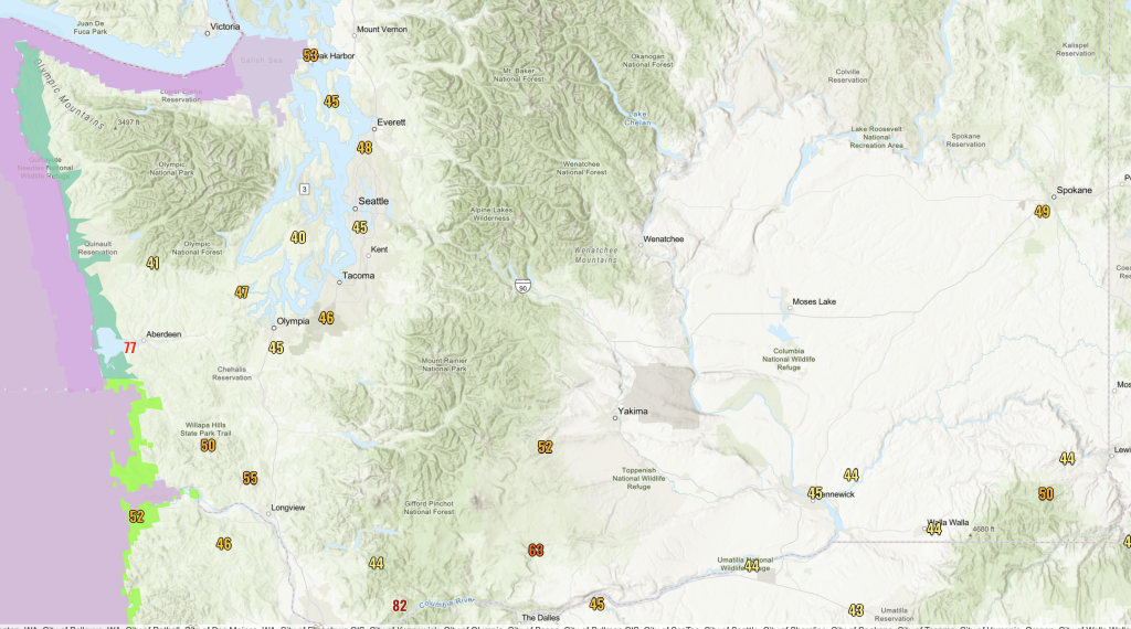
On October 24, a powerful atmospheric river brought widespread heavy rain to western Washington. SeaTac Airport recorded 1.04” of rainfall, marking the first calendar day to receive at least 1.00” of precipitation since April 26, 2024. That’s a streak of 546 days without a 1.00” daily rainfall total, and the third longest streak since records began in 1945. This storm also brought strong winds to the Pacific Coast, Puget Sound, the Strait, and across the Washington-Oregon border. On the 25th, a weather station near the Columbia Gorge recorded a gust of 82mph and Hoquiam Airport recorded a gust of 77mph. Gusts near 40-50mph were common throughout Puget Sound and across southern Washington as well.
On the afternoon of October 26, damaging thunderstorms rolled through the Spokane Metro area. The National Weather Service reported an observed wind gust of 49 mph at Spokane International Airport and radar-indicated winds near 57 mph. After conducting a damage survey, they determined that there was likely a very localized swatch of 55-68mph wind gusts in the northeastern section of Spokane. Damaging thunderstorms for our region are already a rare phenomena, but thunderstorms in late October are even rarer. The summer months are typically our most active period for thunderstorms in eastern Washington.
 Maximum wind gusts on Saturday, October 25 as a powerful low pressure system moved up the coast.
Multiple rounds of rain continued through the rest of October. Rounding out the month was a characteristically soggy Halloween in western Washington. Rain reached the coast in the morning, the I-5 corridor in the afternoon, and then continued through much of the evening and overnight hours. Despite widespread reports of soggy costumes and wet candy, celebrations continued as always (our kids are made of sterner stuff!).
Rain totals by the morning of November 1 reached 2-4 inches on the coast and the Cascades and over an inch around Puget Sound. Most locations in eastern Washington received at least trace-0.10” of precipitation on Halloween night aside from some dry spots near the Tri Cities, Pullman, and Spokane.
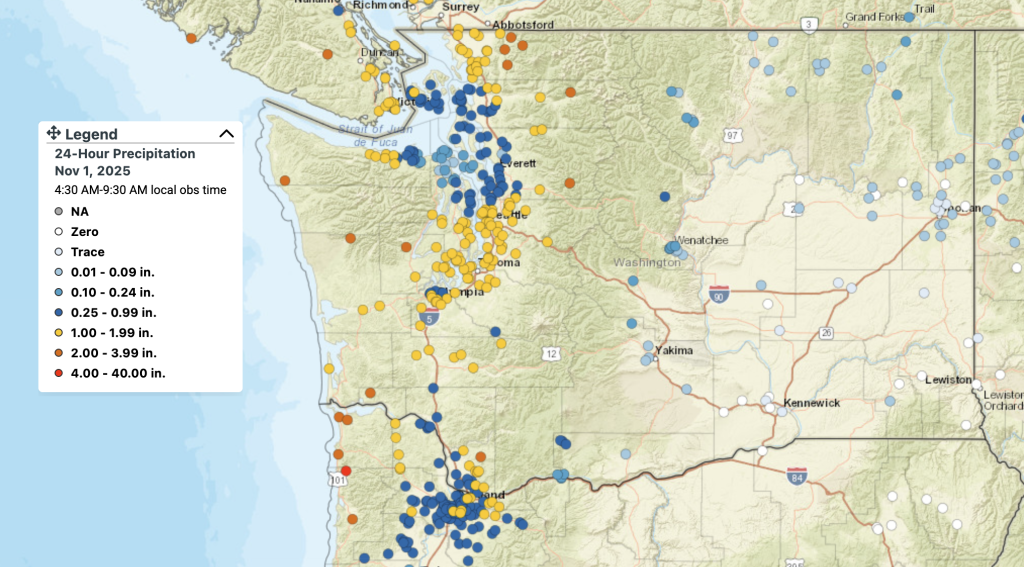 Map of accumulated precipitation on Halloween through the morning of November 1 from the CoCoRaHS observing network.