By Nick Bond
Much of Washington state features steep terrain and unconsolidated soils, which means that landslides are a regular part of the landscape. And since many of these slides are associated with heavy rainfall, they occur more often in the winter, with plenty of exceptions. Of course they can also be triggered by a variety of other agents such as earthquakes, volcanic eruptions, water level changes, and human activities; here we focus on landslides associated with the weather. The purpose of this piece is to provide a brief discussion of their causes and relevant factors, summaries of some recent notable events, and some links for more information.
The landslides caused by intense rainfall tend to be shallow, fast-moving, and accompanied by debris, which makes them particularly hazardous. They often occur in locations where porous soils overlie more impermeable layers of clay or bedrock. The water that percolates down through this porous layer serves to float the sand and gravel particles above the interface with the lower layer. This reduces the binding between the layers, and if it gets low enough, the upper layer slumps under the force of gravity. It bears emphasizing that the threat of landslides is not related just to the steepness of the slope but also factors such as composition of the soil and landform characteristics such as bedrock hollows, many of which can be hidden. Our actions can increase (or decrease) the hazard. The removal of mature vegetation is an obvious example, but stability can also be compromised due to diversion of extra water onto a hillside, and by excavation, particularly at the toe of a slope.
Landslides or mudslides have been included in 10 of the Major Disaster Declarations by the federal government for WA since 1989. There are a few specific examples from the past couple of decades that are especially memorable. The holiday season of 1996-97 in the Puget Sound region is remembered for its one-two punch of snow followed by heavy rain. This caused a host of problems including the collapse of roofs and marinas, flooding, and slides resulting in millions of dollars of damage and at least 4 fatalities, with locations at the bases of steep coastal bluffs being particularly hard-hit. An intense and unusually slow-moving storm in December 2007 produced not just an extended period of strong winds on the coast but also record-setting rainfall in southwestern WA, with as much as 14.35 inches recorded in a 24-hour period in the watershed of the Chehalis River. Landslides numbering at least in the hundreds were the consequence with numerous road closures (Figure 1). The impacts of clear-cutting on some of the more major slides are still being sorted out. The wait was not long for another severe event that affected much of the state. January 2009 brought warm, drenching rains on the heels of wintry weather during late December 2008. An outcome was landslides from Cowlitz County in the south to Whatcom County in the north, with most of the damage of this sort in the Cascade Mountains. This event resembled that of 1996-97 in that it featured rain on snow at the locations of many of the slides. Perhaps snow on the ground is not just an additional source of water, but through its weight can also have a significant influence on the stability of slopes, especially ones near the threshold of failure.
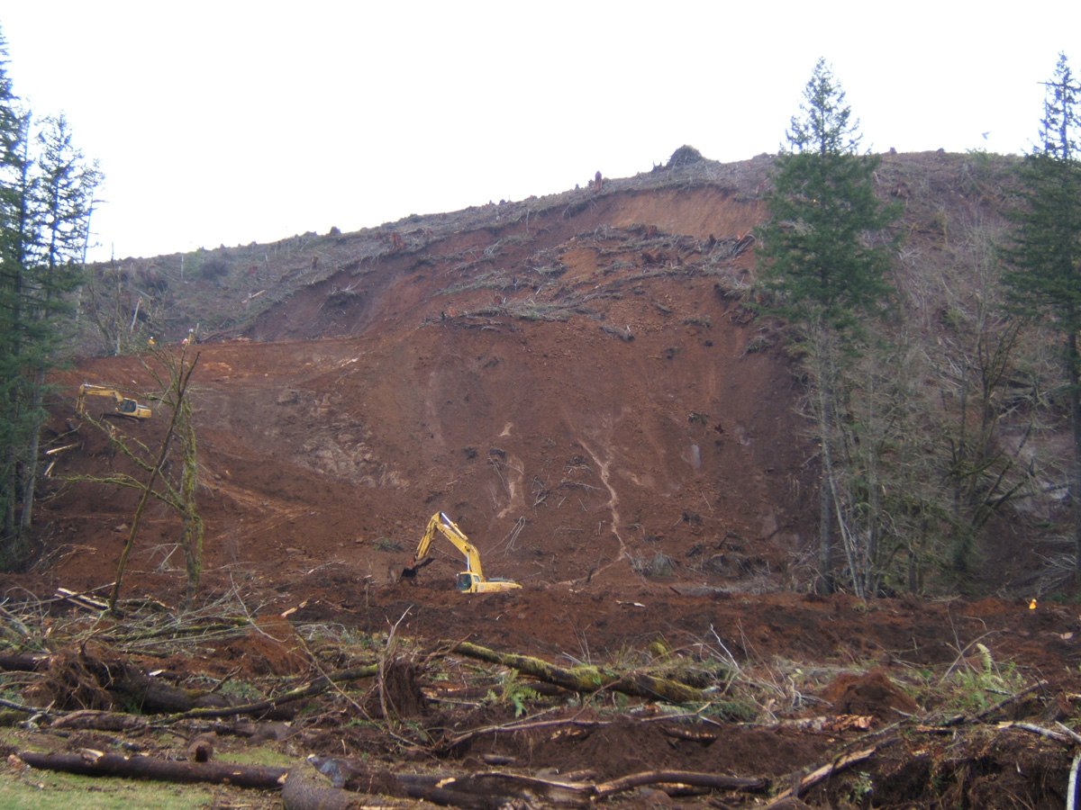 Figure 1: The Pe Ell landslide of December 3, 2007. This slide blocked State Route 6 and damaged three structures (from the Department of Natural Resources)
While the emphasis here is on the fast-moving landslides usually associated with rain, it is noted that these are not restricted to the west side of Washington state. The Okanogan Highlands extending from the North Cascades eastward to the Selkirk Mountains is one of the “landscape provinces” of WA. This region is subject to debris flows caused by thunderstorms, often in late spring through summer. Some of these have even produced damaging tsunamis on Lake Roosevelt behind Grand Coulee Dam. Our state is also subject to deep, slow-moving slides. A notable recent example of this sort is the Aldercrest-Banyon landslide that occurred near Kelso from 1998 into 1999. It resulted in 137 homes being condemned (about $70 million in total damage). While it was not due to a single weather event, it is hypothesized that above-normal precipitation during the 3-4 years preceding the slide was an important contributing factor.
At the time of this writing (late November 2013), there have already been a few minor slides this wet season even though there has not been much in the way of floods (at least yet). There are a variety of resources available online for readers interested in landslides (e.g., Figure 2), particularly materials posted by Department of Natural Resources (DNR) such as the following: https://www.dnr.wa.gov/programs-and- services/geology/geologic-hazards/landslides. The Department of Ecology also provides information, with a focus on Puget Sound (https://ecology.wa.gov/water-shorelines/shoreline-coastal-management/hazards/coastal-landslides). Two products that are still in development use indices to track landslide likelihood – one is an online hazard map based on recent rainfall from DNR (http://www.dnr.wa.gov/geologyportal) and the other compares recent conditions to a landslide threshold for the Seattle area from USGS (https://www.usgs.gov/programs/landslide-hazards/science/landslide-monitoring-stations). Both of these tools were developed in collaboration with the National Weather Service, which additionally provides Special Weather Statements regarding landslide threats beyond what these tools incorporate in the indices.
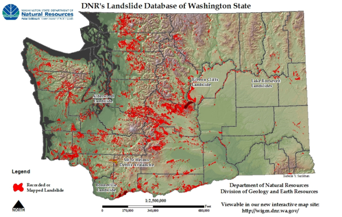 Figure 2: Mapped landslides from the Washington Interactive Geologic Map (http://www.dnr.wa.gov/geologyportal).