By Jacob Genuise
Key Messages:
- Temperatures were above normal statewide due to both mild daytime maximums and mild nighttime minimums.
- Atmospheric river events on November 1-3 and 5-8 brought heavy rainfall to western Washington.
- Thanksgiving storms brought moderate snow across the Cascades and light lowland snow in the northern Columbia Basin, and near Spokane on one of the busiest travel weeks of the year.
Temperatures were above average statewide in November, and these warm temperatures are reflected in graphs of daily high and low temperatures at Seattle-Tacoma Airport and Spokane.
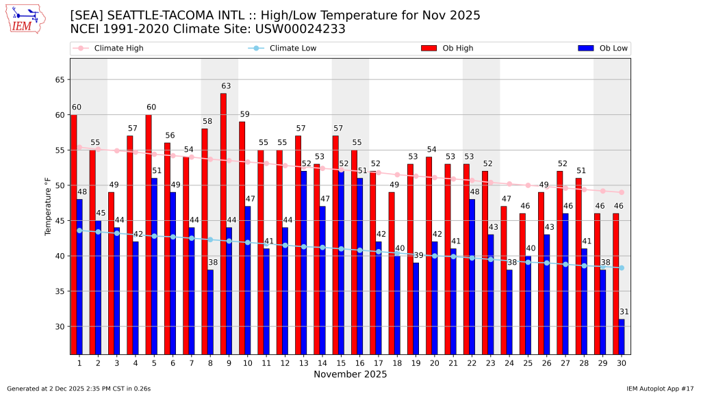 November 2025 daily high (red bars) and low (blue bars) temperatures as well as normal high and low (pink and light blue lines, respectively) for SeaTac Airport. Gray shading denotes weekends. Normals are based on the period 1991-2020.
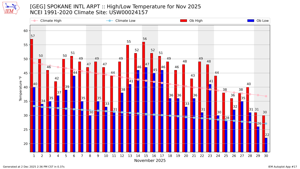 November 2025 daily high (red bars) and low (blue bars) temperatures as well as normal high and low (pink and light blue lines, respectively) for Spokane International Airport. Gray shading denotes weekends. Normals are based on the period 1991-2020.
Daytime maximums consistently rose above long-term averages, and nighttime minimums were even more impressive. From November 14-17, minimum temperatures failed to drop below 45 degrees for 4 days in a row at Spokane International Airport. This has only happened two other times in November since 1881 at this station, including a 4-day stretch in November of 2008 and a 6-day stretch in November of 2014.
November is, on average, the wettest month of the year for most locations around the state, followed closely by December. So, perhaps unsurprisingly, November kicked off with a healthy dose of rain as an atmospheric river impacted the state from November 1-3. This storm was quite warm and did little to boost snowpack.
Another notable atmospheric river brought heavy rain to western Washington from November 5-8 with daily rain totals of 3-6” across the Olympics and Cascades. A consistent drumbeat of more typical weather systems then continued through the rest of the month. This CoCoRaHS map of monthly rain totals below illustrates statewide rainfall nicely. Rain totals exceeded 10” in the Olympic Peninsula and the windward side of the Cascades with reports near 6-8” across Puget Sound and the Vancouver-Portland metro.
 Map of accumulated precipitation during November 2025 recorded by CoCoRaHS observers.
A couple of storms around Thanksgiving brought moderate snow to the Cascades and northeastern mountains. Multi-day snow totals were 12.0” at Paradise on Mt. Rainier, 13.0” at Snoqualmie Pass, 4.6” in Mazama, and around 1.0” for areas north of the I-90 corridor through eastern Washington. Minor snow (Trace-2.00”) can be seen across this region of eastern Washington, shaded in gray on the map of snow depth below. This active snowfall coupled with patchy freezing fog made for challenging holiday travel conditions at times across eastern Washington.
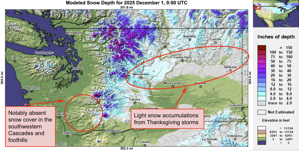 Modeled snow depth (not snow water equivalent) on December 1, 2025.
Despite this snowfall in lowland areas, mountain snowpack has fallen behind the average for this point in the season. Notably, measurable snowcover is still largely absent in the middle elevations of the southern Cascades near Mount Saint Helens. Read the Snowpack and Drought Summary for more information on the current snowpack status.