By Jacob Genuise
Considerable snowmelt continued through May as warm and dry conditions continued in the mountains. The difference in snowpack coverage can be seen clearly by comparing maps of May 1 and June 1 SWE, courtesy of the National Operational Hydrologic Remote Sensing Center (NOHRSC). The Blue Mountains in southeastern Washington and the Okanogan Highlands/Rockies in northeastern Washington have almost completely melted out as of June 1. Most middle and lower elevation locations in the Cascades and the Olympics have also melted out.
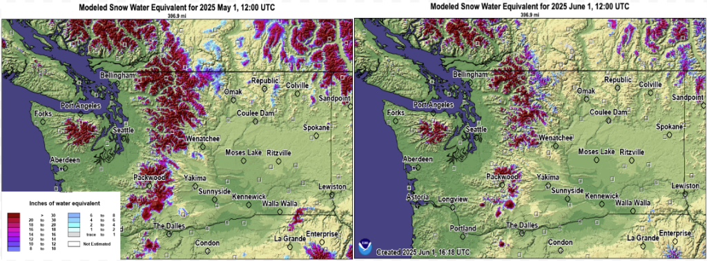 Snow Water Equivalent (SWE) as of May 1, 2025 (left) and June 1, 2025 (right).
A SWE graph of the Lower Yakima Basin shows this earlier than normal melt. The SNOTEL monitoring sites for the Lower Yakima Basin reached 0.0” snow water equivalent a little over a week before the 1991-2020 median date. Most basins in the state are on track to melt out around 1-2 weeks earlier than normal, with some of the individual sites melting 2-4 weeks earlier than normal.
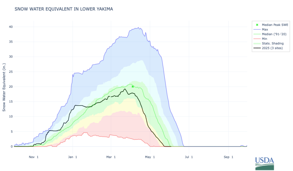 Snow water equivalent for Lower Yakima Basin SNOTEL sites.
Our precipitation deficit and dwindling snowpack have also led to below normal streamflow across much of the state, especially in the Cascades, the Olympic Peninsula, and notably the Yakima River, as seen in orange and brick red shading on the USGS streamflow map.
 Streamflow as percent of normal, averaged by hydrologic unit for the 28-day period ending on June 1, 2025.
According to the U.S. Drought Monitor, Moderate Drought (D1) conditions continue in much of the Cascade Mountains and western Cascade Foothills and expanded into the southern I-5 Corridor near Castle Rock and Vancouver. These drought conditions will persist through June and are likely to persist through at least August 2025. Abnormally dry conditions continue across the rest of western Washington and have also expanded further into portions of the western Columbia Plateau, the Okanogans, and the Blue Mountains.
The Washington Department of Ecology also announced an expansion of their drought declaration on June 5th, 2025 due to ‘early and rapid snowmelt, combined with unusually dry April and May weather.’
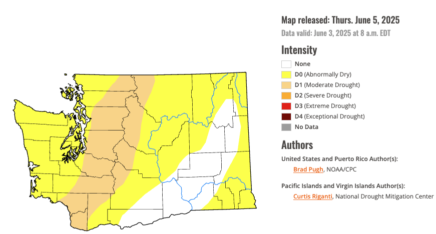 Drought conditions in Washington State as of June 3rd, 2025.