By Jacob Genuise
Key Messages:
- Temperatures were about 1-4°F above normal in the eastern half of the state and near normal in much of western Washington. Small areas of below normal temperatures occurred in the higher elevations of the northwest Cascades.
- Near-record monthly precipitation occurred across the eastern shores of Puget Sound and in the western slopes of the Cascades. Well above normal precipitation also occurred in the southeastern corner of the state near Pullman.
- Below normal precipitation occurred in the Okanogans and northern Rockies as well as near Yakima and the Tri-cities.
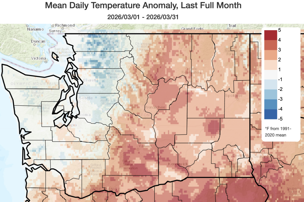 March 2026 mean temperatures compared to 1991-2020 normals.
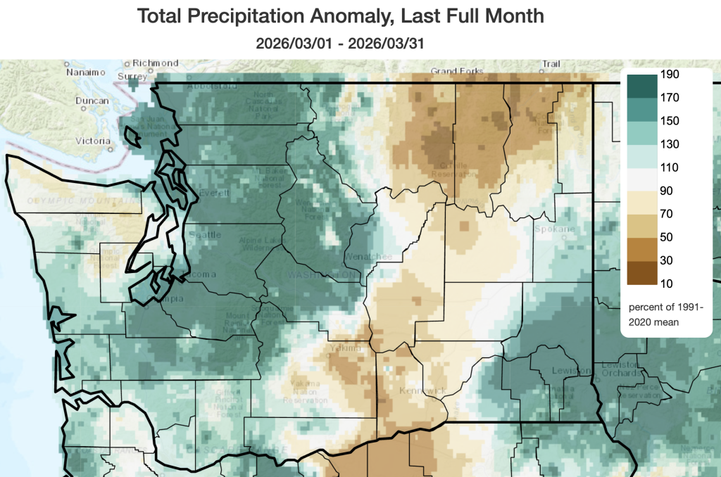 March 2026 precipitation as a percent of 1991-2020 normals.
Temperature: Temperatures were once again above normal across the eastern half of the state with temperatures 1-4°F above normal. This included temperature anomalies of +2.3°F in Spokane, +2.9°F in Omak, +1.7°F in Pullman, and +3.9°F in Hanford. Across western Washington, above normal temperatures occurred only in the far southern I-5 corridor including +1.7°F in Vancouver, Washington. Throughout the rest of western Washington, temperatures were mostly near normal in the lowlands (+0.3°F at the Seattle National Weather Service office, +0.5°F in Olympia, and -0.5°F in Hoquiam) and slightly below normal in the higher elevations of the northwestern Cascades.
Precipitation: Active weather with multiple atmospheric rivers brought well above normal precipitation across western Washington. A few areas along the northern Sound near Bellingham and in the western slopes of the Cascades recorded near record monthly precipitation. Some locations in eastern Washington also recorded well above normal precipitation including the eastern slopes of the Cascades near Wenatchee and across southeastern Washington near Pullman. The table below shows precipitation rankings for the month at selected stations. It was the 2nd wettest March on record in Pullman, Bellingham, and at the Olallie Meadows SNOTEL which is located on a ridgeline just above Snoqualmie Pass.
Below normal precipitation occurred across Okanogan, Ferry, and Stevens counties in the northern tier of the state and in the Columbia Basin from Yakima to the Tri Cities. Slightly below normal precipitation occurred on the northern and eastern slopes of the Olympics. Although a wet March is helpful for improving drought conditions, many reservoirs were unable to collect runoff as they were already nearly full and needed to retain capacity to capture spring snowmelt and prevent snowmelt-related spring flooding.
 March 2026 precipitation rankings for select stations across Washington.
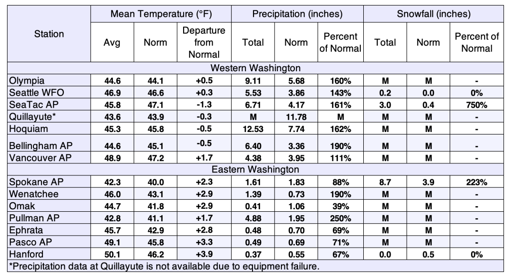 March 2026 climate summaries for select locations around Washington. Anomalies are relative to a climate normal baseline of 1991-2020.