By Jacob Genuise
Key Messages:
- Temperatures were once again above normal across the state, marking the 6th straight month with above normal statewide temperatures.
- Temperatures were 2-4°F above normal in most places, with the warmest temperatures relative to normal occurring in the eastern and southern slopes of the Cascades and across the Olympic Peninsula.
- April was a dry month across much of western Washington with particularly dry conditions (30-50% of normal) across the Olympic Peninsula and the central and northern Cascades. The Okanogans and Rocky Mountains of northeastern Washington were also drier than normal.
- Above normal precipitation occurred across the Columbia Basin near Ephrata, the Tri-Cities, and Walla Walla. Areas near Yakima observed near normal precipitation.
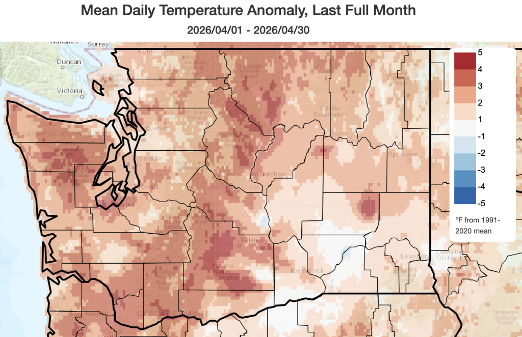 April 2026 mean temperatures compared to 1991-2020 normals.
Temperature: April marked the 6th straight month of above normal statewide average temperatures in Washington. Temperatures were 2-4°F above normal in most places with the highest anomalies above normal occurring in the eastern slopes of the Cascades, the Olympic Peninsula, and in the central and southern Washington Cascades, and the far southern I-5 corridor near Vancouver, Washington. Temperatures in these areas approached 4-5°F above normal. Temperatures were closer to normal near Walla Walla (+0.6°F), the Tri Cities (+0.5°F) and in Pullman (+0.2°F).
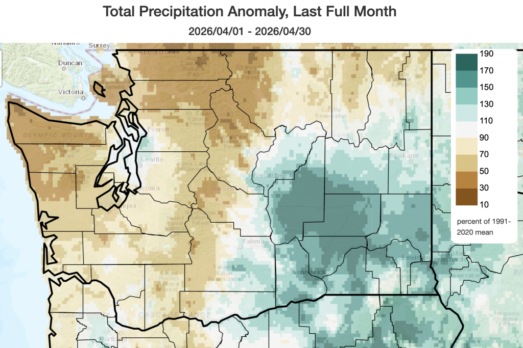 April 2026 precipitation as a percent of 1991-2020 normals.
Precipitation: Precipitation was highly variable across the state with a clear east-west divide between the “haves” and the “have nots”. Eastern Washington, particularly the central and eastern Columbia Basin, enjoyed above normal precipitation in April. Much of this eastern Washington precipitation fell on April 22. Pop-up thunderstorms on the 28th also prompted flood advisories for the Spokane Metro region as nearly stationary thunderstorms brought localized moderate to heavy precipitation. Precipitation was over 150% of normal in Wenatchee, Pullman, Ephrata, and the Tri Cities. Near Yakima and Ellensburg, precipitation was near-normal.
Western Washington fell squarely in the “have nots” category with below normal precipitation from the Cascades Crest to the Pacific Coast. Precipitation was only around 30-70% of normal in most places, and the driest areas relative to normal were in the northwestern Olympic Peninsula and the northern and central Cascades. A small area in the northern Seattle Metro region experienced near or slightly above normal precipitation thanks mostly to a thunderstorm complex on April 15 which brought heavy downpours, hail, and a waterspout on Puget Sound. This thunderstorm was associated with a Puget Sound Convergence Zone following a strong frontal passage.
More information on the day-to-day variations in weather for the past month and the warm/cold and wet/dry streaks can be found on the revamped National Weather Service climatology pages; you can access locations within the Seattle, Spokane, Portland, and Pendleton forecast areas.
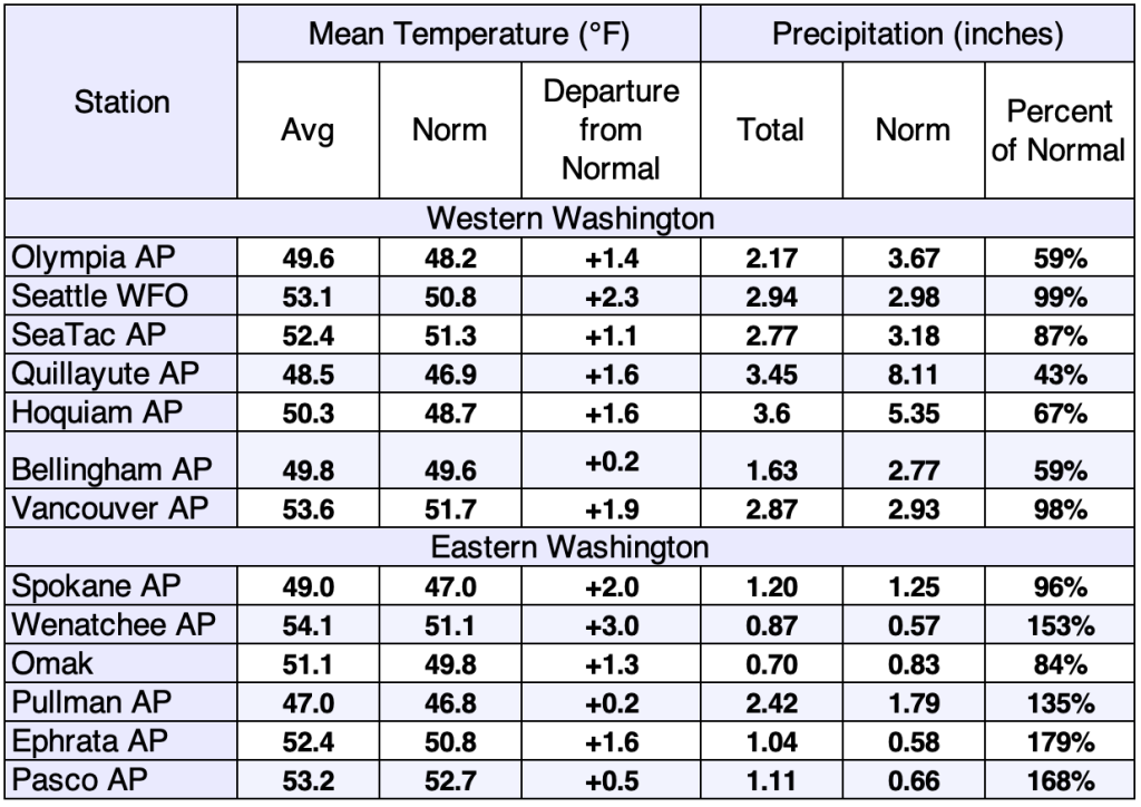 April 2026 climate summaries for select locations around Washington. Anomalies are relative to a climate normal baseline of 1991-2020. The Quillayute precipitation gauge has been replaced, and data will be provided here moving forward.