By Jacob Genuise
Key Messages:
- Temperatures were 2-6°F above normal across the state, marking the 7th consecutive month with above normal statewide temperatures.
- The warmest temperatures relative to normal occurred in the eastern slopes of the Cascades and across central and northeastern Washington.
- April was drier than normal when averaged statewide with less than 50% of normal precipitation across much of central Puget Sound, the Olympic Peninsula, the Okanogans, and southeastern Washington. Precipitation was below 30% of normal near the Tri-Cities and Walla Walla.
- Small pockets of near or just above normal precipitation occurred near Wenatchee and The Dalles/Dallesport, largely due to thunderstorms on May 28th.
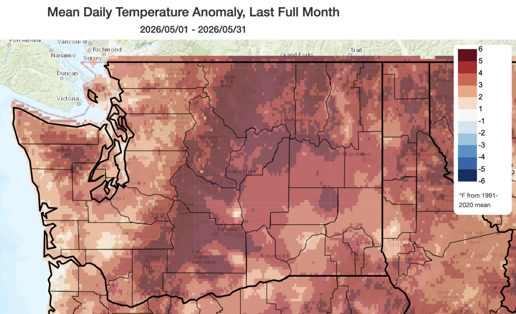 May 2026 mean temperatures compared to 1991-2020 normals.
Temperature: Temperatures were above normal in May across the entire state. Across western Washington, temperatures were generally 1-3°F above normal including +1.9°F in Seattle, +1.2°F Quillayute, +1.6°F in Olympia, and +2.6°F in Vancouver, Washington. Across eastern Washington, temperatures were 3-6°F above normal with the highest temperatures relative to normal occurring across the eastern slopes of the Cascades and across northeastern Washington. In these areas, temperatures were +5-6°F above normal. Other departures included +3.1°F in Spokane, +2.5°F in Pasco/Tri-Cities, and +4.9°F in Wenatchee.
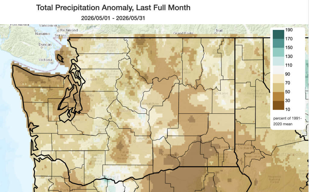 May 2026 precipitation as a percent of 1991-2020 normals.
Precipitation: May was overall a dry month for the majority of the state. Many areas received around 50-70% of normal monthly precipitation; some specific totals include 42% of normal at SeaTac Airport, 60% of normal in Hoquiam, and 74% of normal in Pullman. The driest conditions relative to normal occurred in the northern Olympic Peninsula, isolated pockets on the eastern slopes of the Cascades, and in far southeastern Washington including only 8% of normal precipitation in the Tri-Cities/Pasco area.
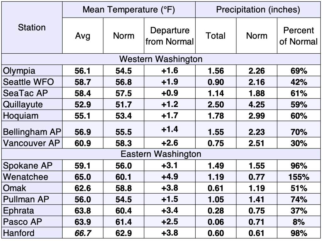 May 2026 climate summaries for select locations around Washington. Anomalies are relative to a climate normal baseline of 1991-2020.
A few locations such as Wenatchee (155% of normal) and Hanford (98% of normal) recorded near or above normal precipitation largely thanks to a single thunderstorm complex on May 28th. Thunderstorms brought widespread winds and localized heavy rainfall, boosting some local totals. However, in most areas of eastern Washington precipitation from these thunderstorms did not make up for the dry conditions throughout the rest of the month. Becoming an observer for the CoCoRaHS program is a great way to help us better understand localized thunderstorm rainfall! More information on the day-to-day variations in weather for the past month and the warm/cold and wet/dry streaks can be found on the revamped National Weather Service climatology pages; you can access locations within the Seattle, Spokane, Portland, and Pendleton forecast areas.