By Jacob Genuise
What’s Next for the Pacific Northwest?
Expectations for warmer and drier conditions continue statewide.
The Climate Prediction Center’s monthly outlook for June 2026 continues to show above normal temperatures are likely statewide. The entire state has an elevated 60-70% chance of above normal temperatures. There are also elevated chances of below normal precipitation, especially across western Washington where a 40-50% chance of below normal precipitation exists.
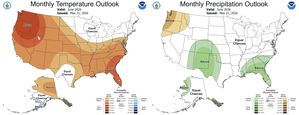
June 2026 temperature (left) and precipitation outlook.The 3-month summer outlook for June-August shows a very similar pattern of elevated chances of above normal temperatures and below normal precipitation statewide. There is a 60-70% chance of above normal temperatures nearly statewide. There is an elevated 40-50% chance of below normal precipitation across far western Washington and a 33-40% chance of such conditions across central and eastern Washington. These summer outlooks continue to raise concerns for the development of drought conditions statewide this summer.
 June-August outlook for temperatures (left) and precipitation (right).
La Niña conditions have ended. El Niño conditions are developing rapidly with a 60% chance of a strong or very strong El Niño developing in the upcoming fall/winter.
As of May14, El Niño conditions are likely to develop very soon. El Niño conditions are virtually certain to remain in place through the upcoming summer, fall, and winter period. Current models show a high likelihood that a strong, very strong, or possibly historic El Niño event will develop this year. There is around a 60% chance of at least a strong El Niño event this year.
El Niño events tend to increase the odds of warmer and drier winter conditions in the PNW. Stronger events do not necessarily indicate stronger impacts are expected, but strong events do increase the likelihood of our region experiencing impacts of El Niño conditions.
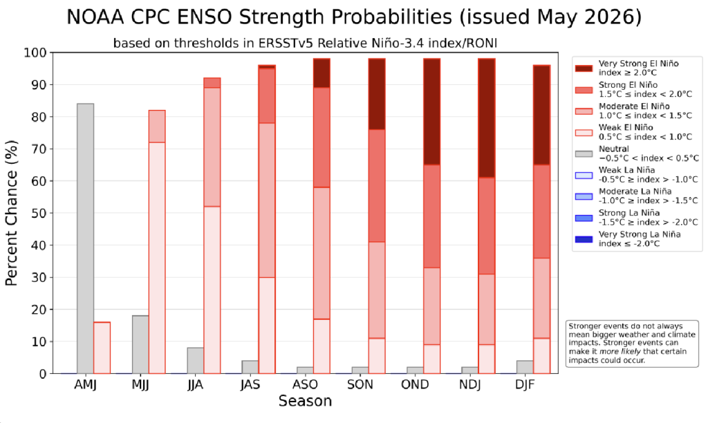 ENSO strength probabilities through February 2027.
.