By Jacob Genuise
March came in like a lamb with fairly settled weather, near-normal temperatures, and generally light precipitation across the state. Wetter systems arrived beginning in the second week of the month and brought steady, beneficial precipitation across much of the state. A ridge of high pressure then strengthened across the region around March 24 and brought a period of spring-like warmth statewide.
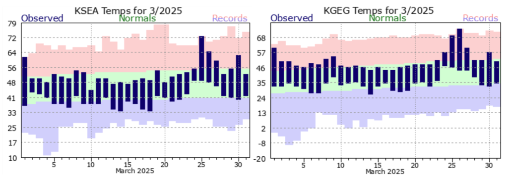 Observed daily high and low temperatures (dark bars) as well as records and normals (background shading) for SeaTac Airport (left) and Spokane International Airport (right).
Many stations broke daily high temperature records on March 25th and 26th as a result, and some long-standing stations broke their previous daily records by 5-10°F. The 25th was the warmest day of this event for much of western Washington, with daily high temperature records at Seattle Sand Point WFO (75°F), Bremerton (74°F), Olympia Airport (71°F), Quillayute (66°F), and Rainier Paradise Ranger Station (60°F). Warmth continued to build in eastern Washington into March 27, and Richland (82°F), Walla Walla (79°F), Yakima Airport (76°F), Pullman Moscow Reg. Airport (75°F), and Spokane Airport (75°F) all set daily records on the 27th.
The warmest temperatures were concentrated in the Lower Columbia and Snake River basins as well as in the southern I-5 corridor near Centralia and Vancouver, WA (map). This warmth also set temperature records at many mountain SNOTEL stations and led to a notable drop in snowpack. This snowpack loss is discussed further in the Snowpack and Drought Summary.
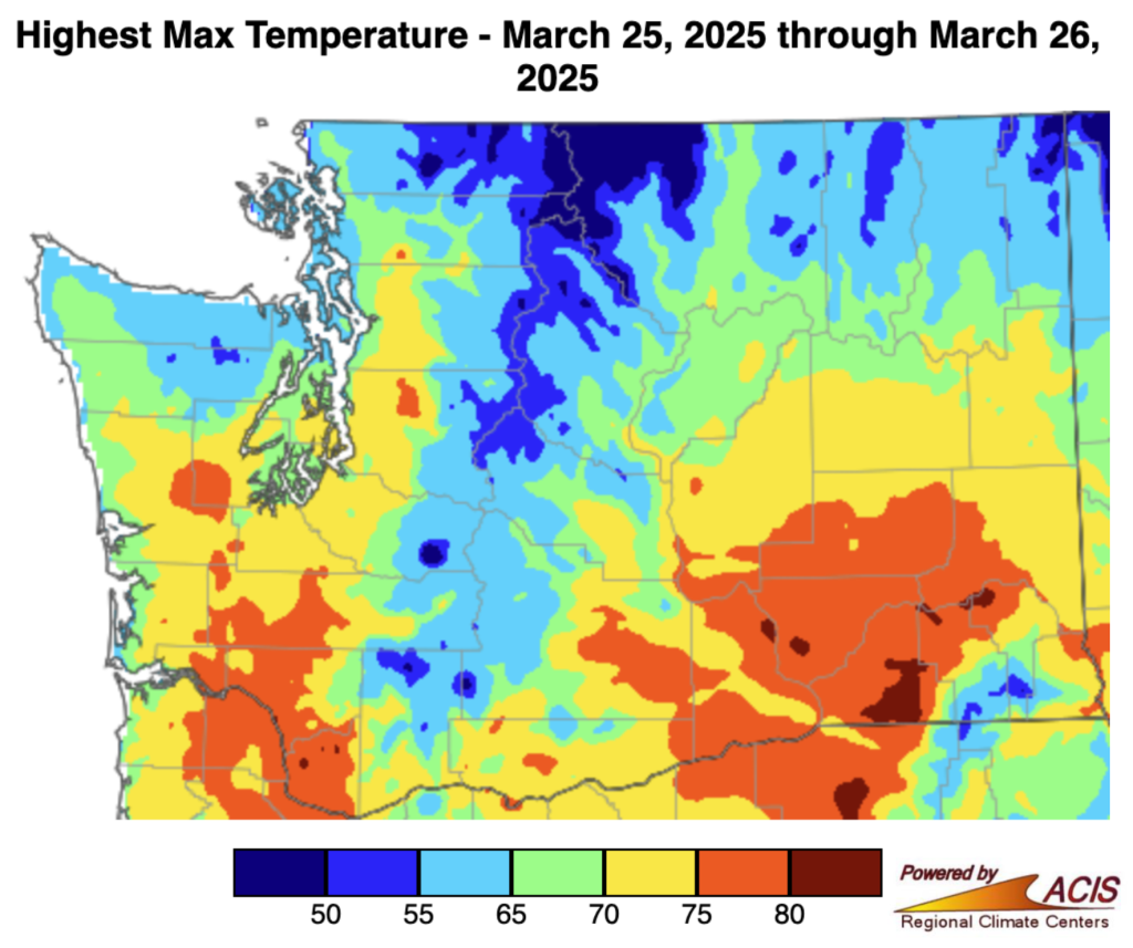 Highest maximum temperature reached from March 25-26, 2025. Map created through ACIS, data from PRISM.
This warm, moist, and unstable air mass also led to an increased severe weather threat beginning in the afternoon of March 26. The Storm Prediction Center, which provides detailed storm outlooks and early warning risk products nationwide, released a “slight” severe thunderstorm risk including both Portland and Seattle. This level of severe weather risk is very rare for our region. Many areas around Puget Sound have not been under an SPC Slight severe thunderstorm risk since 2012, and areas along the southern I-5 corridor haven’t seen a similar risk level since 2005!
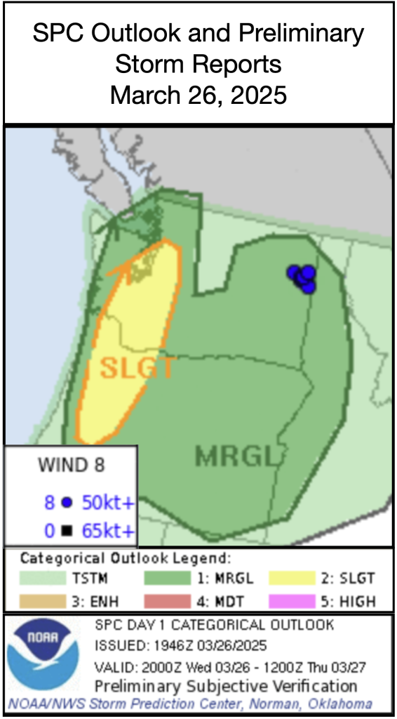 Storm Prediction Center (SPC) storm outlook (shading) and severe wind reports (blue dots) for March 26th, 2025 and overnight into March 27th.
During the late afternoon hours of March 26, a cold front, associated with a low pressure system offshore, arrived from the southwest and brought with it a line of thunderstorms. Cloud cover earlier in the day limited daytime temperatures which in turn limited the amount of energy and instability available for storms to become more intense. As a result, the storms did not produce any severe weather in western Washington. However, pea-sized hail, gusty winds, moderate to heavy rainfall, and frequent lightning strikes occurred around the Sound and Olympic Peninsula through the late afternoon and evening.
Later that evening, this cold front initiated a new line of storms near the Tri Cities. These storms then strengthened as they approached the Spokane Metro and produced severe wind reports shortly after midnight. The Deer Park Airport ASOS station to the north of Spokane recorded a gust of 67 mph and the National Weather Service also observed numerous downed trees in the area.
These storms died out overnight, and temperatures returned to near normal following the passage of the cold front. The remainder of the month featured additional showery precipitation across the state including a few weak thunderstorms across eastern Washington. Temperatures also held near-normal for the last few days of the month.