By Jacob Genuise
Key Messages:
- ENSO-neutral conditions are still present, but a transition to El Niño is expected very soon. El Niño is likely to continue to strengthen into the fall.
- The summer (June-August) outlook indicates elevated chances of warmer and drier than normal conditions.
- Warmer than normal conditions are particularly likely this summer with a 60-70% chance of such conditions across much of the state.
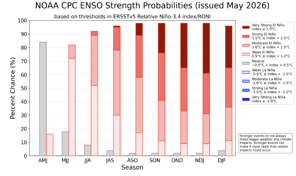 ENSO strength probability forecast through Dec-February 2026.
Neutral ENSO conditions continue, but an El Niño Watch is in place indicating that El Niño is very likely to develop soon. There is an 82% chance of El Niño developing during the current May-July period, and El Niño is likely to strengthen through the summer and into the fall. ENSO ensemble forecasts continue to show high confidence in El Niño for the upcoming fall and winter with a nearly 90% chance of moderate, strong, or very strong El Niño by early winter.
What does this mean for Washington?
El Niño increases our odds of seeing warmer and drier conditions in the fall and winter, likely resulting in less spring 2027 snowpack. However, it is unlikely to impact this upcoming summer’s conditions given that the El Niño event will take some time to develop through the summer and into the fall, and historically ENSO events have the greatest impact on our winter conditions.
Summer Outlooks
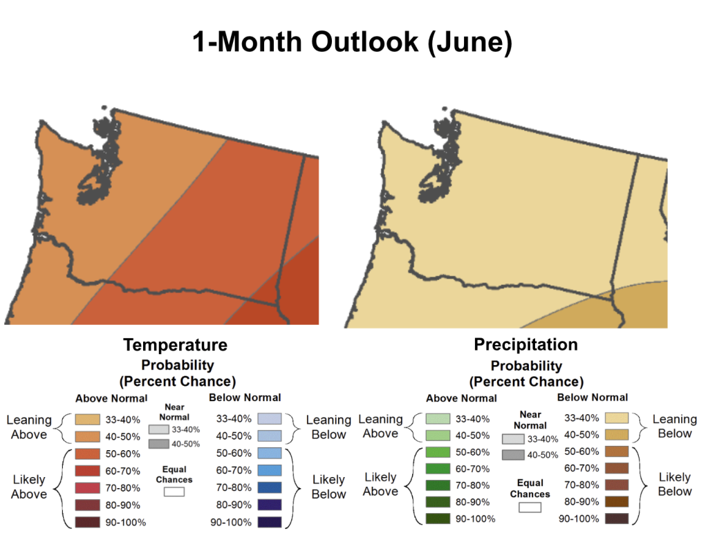 1-month (June) outlook for temperature (left) and precipitation (right) in Washington State.
Taking a look at the 1-month outlook for June, the Climate Prediction Center expects higher chances of statewide conditions that are both warmer and drier than normal. These outlooks are on a three-category scale, meaning that if there was no forecast skill for a particular forecast period then there would be a 33.3% chance of below, equal to, or above normal outcome. There is a 40-50% chance of warmer than normal conditions across western Washington, a higher (50-60%) chance of such conditions across much of eastern Washington, and a higher (60-70%) chance across the far southeastern corner of the state near Pullman, Pomeroy, and Anatone. A slightly elevated (33-40%) chance of drier than normal conditions exists almost statewide.
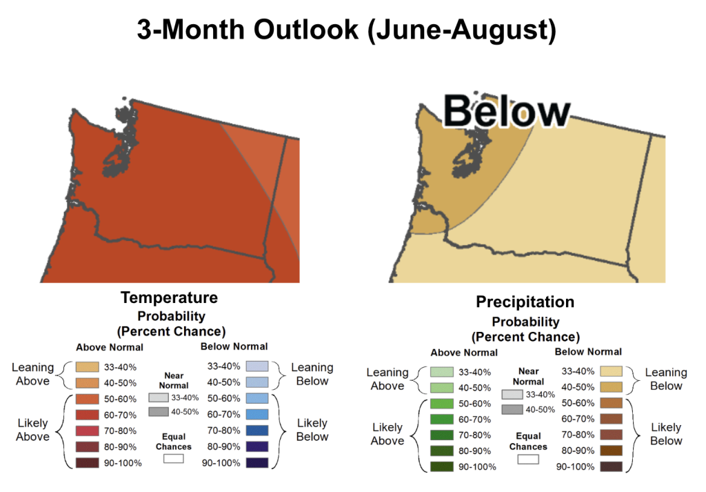 3-month (June, July, August) outlook for temperature (left) and precipitation (right) in Washington State.
The 3-month outlook shows similar warmer and drier than normal conditions are favored for the summer (June-August) period. Confidence is highest in the temperature outlook with a 60-70% chance of warmer than normal conditions nearly statewide. As for precipitation, there is a 40-50% chance of below normal precipitation centered over Puget Sound and much of western Washington while the rest of the state shows only slightly elevated chances of below normal precipitation.
These warm and dry outlooks continue to elevate drought concerns this upcoming summer. We are likely to see expansion in drought extent and severity across the state as summer gets rolling. Wildfire season is also likely to ramp up faster than normal this year. The Washington Smoke Blog recently posted an explainer on how our recent winter and spring conditions may impact the upcoming fire season.